montgomery county today
57
Steep Slope Locations
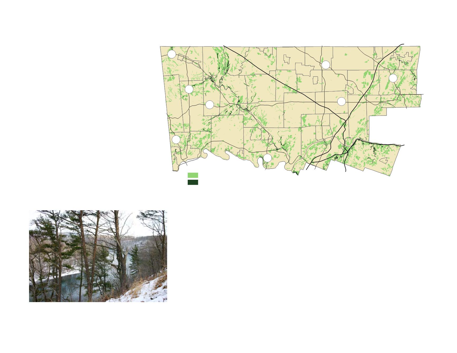
The concentrations of steep slopes are most often associated with particular geologic formations
such as the diabase intrusions in the western portion of the county; the Lockatong argillite, especially
in Upper and Lower Providence Townships; and the Wissahickon Schist in Lower Merion
Township. Major slopes are most prominent along the Schuylkill River valley and major streams
such as the Perkiomen and Pennypack Creeks. The most significant steep slopes in the county can
be found along the Schuylkill Expressway and along Mill Creek in Lower Merion; in portions of
Barren Hill and Miquon in Whitemarsh; along the Perkiomen Creek in Upper Salford, Upper
Providence, and Lower Providence Townships; and along the Pennypack Creek in Abington
Township. Very steep ravines can be found along the Schuylkill River near Mont Clare and in the
Ridge Valley Creek in Salford and Marlborough Townships. Both of these areas support unique
natural habitat.
¯
Pottstown
Norristown
Lansdale
Collegeville
Jenkintown
Conshohocken
476
276
76
476
t
u
422
t
u
202
611
100
309
Hatboro
Ambler
Pennsburg
73
663
29
29
73
Moderately Steep Slopes 15 to 25 %
Very Steep Slopes >25%
FIGURE 45:
Steep Slopes
Dramatic views occur from the cliffs along the Schuylkill River in Upper
Providence Township.
Understanding Slope
Topography is generally expressed through the
percentage of slope. Slope is calculated by the
dividing the vertical elevation change by the
horizontal distance in which the change takes
place. To do this typically a contour map is
consulted. Basic slopes used in most planning
work are as follows:
•
33% slope–3:1 slope; maximum slope for
grassed areas
•
Greater than 25%–very steep; usually most
development is prohibited
•
15%-25%–steep; some limitations on
development
•
7%–maximum grade for public roads
•
2%–minimum grade for drainage on grassed
areas
•
1%–minimum grade for drainage on roads
Source: U.S. Geological Survey


