montgomery county today
53
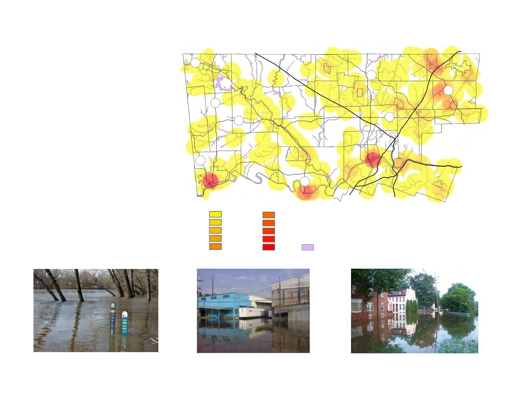
FIGURE 44:
Floodplain Areas
Floodplains are suitable for recreation uses.
Flooding can impact businesses.
Flooding in Pottstown from the Manatawny Creek.
Flood Prone Areas of the County
Most of the flood damage in the county has
occurred along the Schuylkill River, Perkiomen
Creek, Wissahickon Creek (including the Sandy
Run), Pennypack Creek and Tookany Creek.
Pottstown Borough, the Mont Clare Port
Providence area of Upper Providence Township,
Port Indian area of West Norriton Township,
Norristown, Bridgeport and Conshohocken
Boroughs, and the River Road part of Lower
Merion Township have sustained damage during
Schuylkill River floods. Collegeville has received
the most damage from Perkiomen Creek floods.
The Wissahickon Creek flooding has caused
damage in Ambler Borough and portions of
Springfield and Whitemarsh Townships. Floods
along the Sandy Run have occurred in Upper
Dublin and Abington Townships. The Pennypack
Creek flooding has damaged Horsham Township
and Hatboro, as well as Upper Moreland, Lower
Moreland, and Abington Townships. Abington
Township, along with Cheltenham Township, has
also sustained flood damage from Tookany Creek.
¯
Pottstown
Norristown
Lansdale
Collegeville
Jenkintown
Conshohocken
476
276
76
476
t
u
422
t
u
202
611
100
309
Hatboro
Ambler
Pennsburg
73
663
29
29
73
Structures in Flood Plain
1-11
12-22
23-32
33-43
44-54
55-64
65-75
76-86
87-97
98-107
1% Annual Floodplain
Source: Montgomery County Planning Commission


