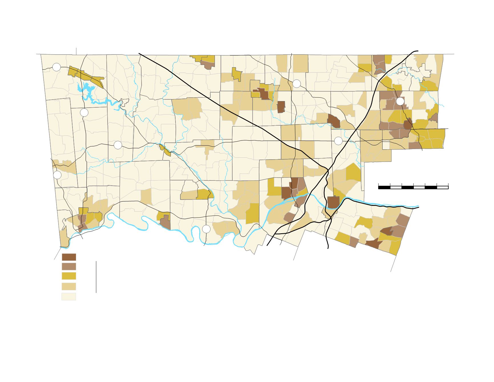
montgomery county today
101
0
1
2
3
4
5
6 Miles
East Greenville
Pennsburg
Red Hill
Green Lane
Schwenksville
Pottstown
West Pottsgrove
Royersford
Trappe
Collegeville
Telford
Souderton
Hatfield
Bor.
Lansdale
North
Wales
Ambler
Hatboro
Bryn Athyn
Jenkintown
Rockledge
Norristown
Bridgeport
Conshohocken
West
Conshohocken
Narberth
Upper Hanover
Douglass
New
Hanover
Marlborough
Salford
Upper
Salford
Upper
Frederick
Lower
Frederick
Franconia
Lower
Salford
Perkiomen
Skippack
Upper
Pottsgrove
Lower
Pottsgrove
Limerick
Upper
Providence
Lower
Providence
Worcester
Whitpain
East Norriton
Plymouth
West
Norriton
Upper
Merion
Towamencin
Hatfield Twp.
Montgomery
Horsham
Upper
Gwynedd
Lower
Gwynedd
Upper
Dublin
Upper
Moreland
Lower Moreland
Abington
Whitemarsh
Springfield
Cheltenham
Lower Merion
¯
Philadelphia
Delaware County
Chester County
Berks County
Lehigh County
Bucks County
Schuylkill River
476
276
76
t
u
422
t
u
202
476
309
611
100
663
29
73
29
73
Most Walkable
Least Walkable
FIGURE 68:
Walkability of County Neighborhoods
Walkability =
Destinations +
Supermarkets, Drug Stores,
Restaurants, Public Schools,
Libraries, Post Offices, Train
Stations, and Bus Stops
Built Environment
People, Street Grid, Commercial Intensity
and Lot Size, Residential Density and Lot
Size, Mix of Uses, Presence of Parking Lots,
and Types of Streets
Sources: Montgomery County Planning Commission and Board of Assessment data. Sidewalk location data was not available.


