Montco 2040:
a shared vision
47
¯
Lorimer Park
Pennypack Trail
Pennypack
Creek
SEPTAWest Trenton
MOREDON RD
HUNTINGDON PIKE
SUSQUEHANNA RD
SHADY LN
VALLEY RD
MILL RD
PINE RD
232
¯
Lower Perkiomen
Valley Park
John James Audubon
Center atMill Grove
Valley Forge
National
Historical Park
Schuylkill River Trail
Schuylkill River Trail
Perkiomen Trail
Audubon Loop Trail
Perkiomen Creek
Schuylkill River
Schuylkill River
Norfolk Southern
Norfolk
Southern
POTTSTOWN EXPY
BLACK ROCK RD
EGYPT RD
PAWLINGS RD
PARK AVE
/
422
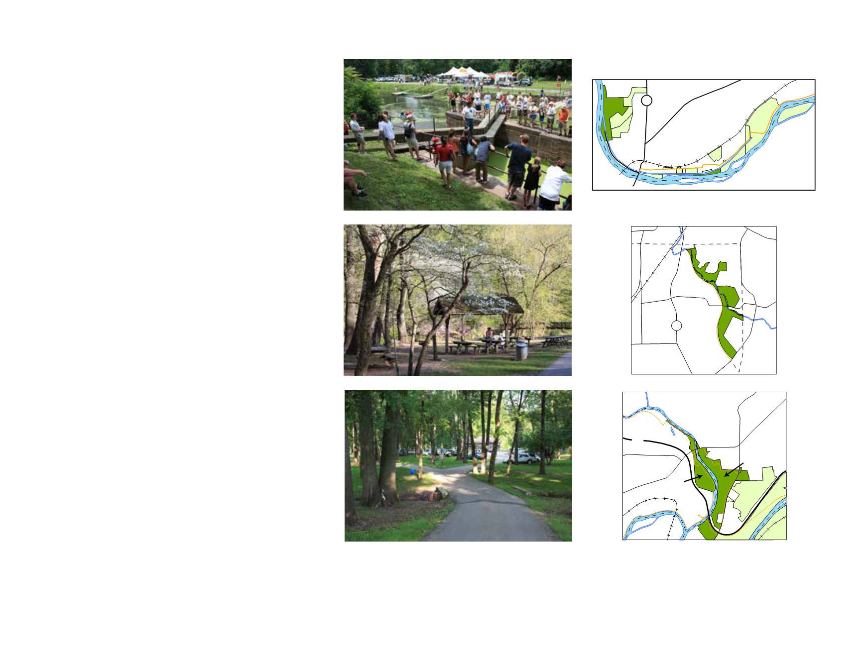
Lock 60 at the Schuylkill Canal Park
This park, consisting of 64 acres, features a working
canal lock, a towpath, and 2.5 miles of canal. Future
improvements might include:
■■ Completion of the towpath restoration.
■■ Connector trail between Lock 60 and the Upper
Schuylkill Valley Park.
■■ Improvements to the mule tenders house as an
interpretive area with signage.
Lorimer Park
This park, consisting of 230 acres, features trails and picnic
areas along Pennypack Creek. Future improvements or
expansions might include:
■■ A trail connection to the north to the Bethayres Swamp,
Huntingdon Valley, Bethayres, and Bryn Athyn.
■■ A trail connection south to Rockledge.
■■ Fitness stations along the trail.
■■ Acquiring additional wood and meadow land near
Moredon Road.
Lower PerkiomenValley Park
This park, consisting of 90 acres, has playing fields,
trailhead parking for the Perkiomen and Schuylkill trails,
and picnic areas along the Perkiomen Creek. Future
improvements might include:
■■ A loop trail.
■■ Fitness stations along the trail.
■■ Pedestrian bridge connecting to the Audubon loop.
■■ Landscaping to provide buffering from Route 422.
■■ Interior upgrades and repairs to buildings.
¯
Lock 60 at the
Schuylkill Canal
Park
Open
Space
by
Others
Schuylkill RiverTrail
Norfolk Southern
SchuylkillRiver
SchuylkillCanal
BRIDGE ST
EGYPT RD
29


